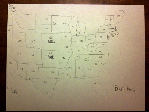
Here is my result (click for a larger version):

All in all, the results are pretty embarrassing, but not a complete failure. Let's look at some of the finer details:
1) Somehow Wisconsin ended up on the left-hand side of Minnesota.
2) Utah snuck up between Nevada and Idaho, when it belongs between Nevada and Colorado.
3) Whoops... where is New Jersey?
4) The NE is a general disaster.
How did yours turn out?
3 comments:
I like that you at least put your name on it, like it was a 4th grade homework assignment. Cute!
Wow dude, I am impressed. Also, no one's going to dock points because you left out Jersey.
I love that Nebraska and Kansas are bigger than Texas! They do feel that way when you're driving across them...
Post a Comment